SETAF2018: Dynamic Soil Profiling and Borehole Data Management
Turn field data into engineering decisions. SETAF2018 centralizes borehole logs, SPT, and MPM test results to generate the most accurate "Idealized Soil Profile" for your project.
A reliable geotechnical design begins with the accurate definition of soil layers and groundwater level. SETAF2018 transfers complex field data from various locations to a digital environment, providing a consistent and high-precision subsurface model for your analyses.
1. Comprehensive Borehole and Field Test Integration
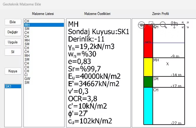
Define each borehole with its coordinates within the software. Create your digital archive by directly processing raw data obtained from field experiments into the system.
2. Creating an Idealized Soil Profile
Synthesize variable data obtained from different borehole locations to create an "Idealized Soil Profile" that represents the entire project.
3. Dynamic Subsurface Visualization
Soil profile data is mapped with the 3D Terrain Model, transforming the layered structure of the subsurface into an engineering visualization.
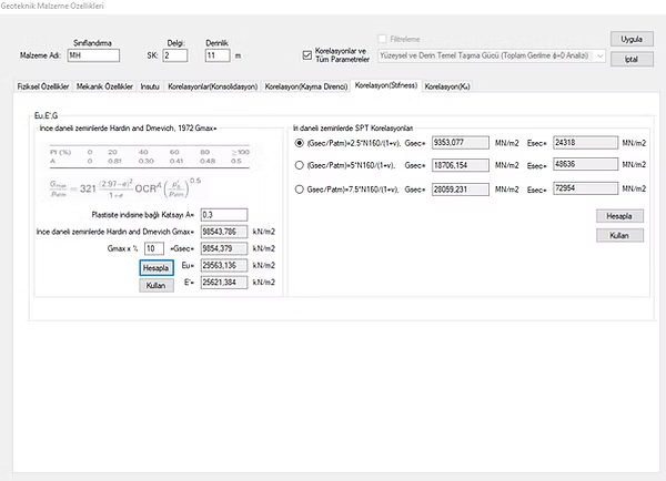
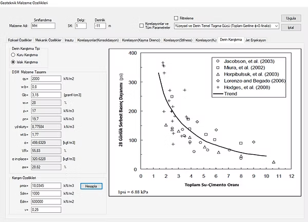
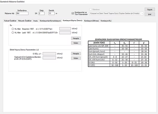
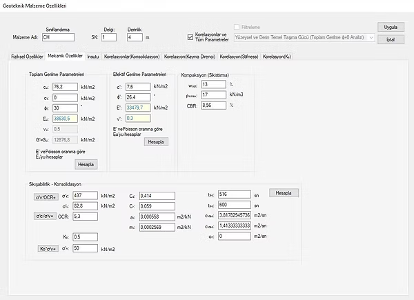
4. Unified Material List & Layer Management
Manage soil layers from a single central hub. Create consistent material definitions throughout the project and leverage automatic data filtering based on the specific analysis type.