A geotechnical report is the document that converts ground investigation data into design parameters and recommendations a structural or civil design can be built on. It records what the ground is, what was measured, how those measurements were interpreted, and what the interpretation means for foundations, excavations and earthworks.
Its content is not a matter of style. A geotechnical investigation report carries a chain: borehole records, field tests, laboratory results, derived parameters, analysis, and recommendations. Each link has to be traceable back to the one before it.
That chain is what makes the document usable. A recommendation that cannot be traced to a measurement is an opinion, and an opinion cannot be checked by a reviewer, defended to an authority, or revised when the structure changes.
A geotechnical report is not a summary of soil conditions. It is an argument, and every step of it has to be auditable.
What Is Inside a Geotechnical Report?
The structure varies between offices and jurisdictions, but the content converges, because each section answers a question the designer cannot proceed without.
| Section | What it contains | What it is used for |
|---|---|---|
| Project and scope | Structure type, loads, location, cadastral data | Fixing the investigation depth and extent |
| Investigation programme | Borehole layout, depths, sampling and field test schedule | Showing the data is representative |
| Ground model | Stratigraphy, groundwater, borehole logs, cross sections | The profile all analysis runs on |
| Laboratory results | Classification, strength, compressibility, consolidation | Deriving design parameters |
| Design parameters | Selected characteristic values per layer | Direct input to calculation |
| Analysis | Bearing capacity, settlement, stability, liquefaction | The quantitative answer |
| Recommendations | Foundation type, depth, allowable pressure, construction notes | What the designer applies |
| Appendices | Logs, test sheets, calculation output | Verification by a third party |
The sections most often thin in practice are the middle ones. Data and recommendations are usually present. The reasoning that connects them is where reports differ in quality.
Where Does the Data Come From?
Ground investigation is planned around the structure, not around a standard depth. The rule that governs the programme is the depth of significant stress increase: boreholes have to reach below the zone where the foundation load still produces meaningful stress change, and that zone depends on foundation width and layout rather than on building height alone.
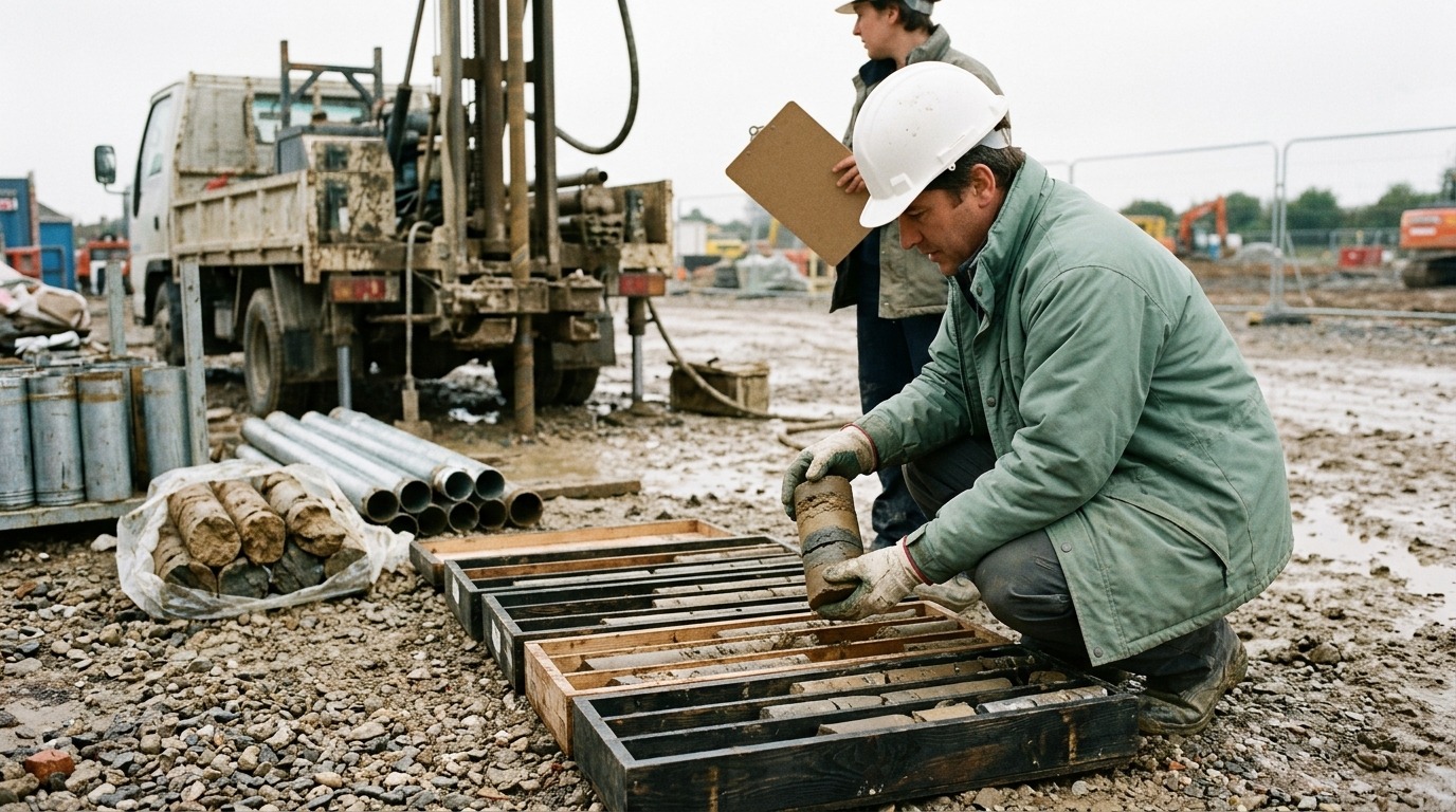
Within each borehole, three kinds of record accumulate. Continuous descriptive logging gives the stratigraphy. In-situ testing, most commonly the standard penetration test, gives strength and stiffness indications at fixed depths. Sampling recovers material for laboratory work, with undisturbed sampling reserved for the cohesive layers where compressibility governs.
Groundwater deserves its own record. A single water level noted at the end of drilling is not a groundwater regime. Artesian pressure, perched water and seasonal variation change effective stresses, and effective stresses change every subsequent number.
Which Laboratory Tests Support the Report?
Laboratory work divides into classification, which identifies the soil, and performance testing, which quantifies how it behaves.
| Test | Parameter obtained | Governs |
|---|---|---|
| Grain size and Atterberg limits | Classification, plasticity index | Soil type, liquefaction screening, correlations |
| Natural water content and unit weight | w, γ, γd | Effective stress profile |
| Oedometer (consolidation) | Cc, Cr, σ′c, cv | Settlement magnitude and rate |
| Direct shear or triaxial | c′, φ′, cu | Bearing capacity and stability |
| Specific gravity | Gs | Phase relationships |
The plasticity index and the saturated unit weight are the two results that reach the largest number of downstream calculations, which is why an error in either propagates further than its own section suggests.
How Are Design Parameters Selected From Scattered Data?
This is the step where the report stops being a record and starts being an interpretation.
A layer does not have a friction angle. It has a set of measurements that scatter, and the engineer selects a characteristic value from them, conservatively where the data is sparse and closer to the mean where it is dense and consistent. Where parameters come from correlations rather than direct measurement, as with SPT N value and friction angle, the correlation used and its applicable range belong in the report.
Two reports can present identical laboratory sheets and different design parameters without either being wrong. What separates them is whether the selection is stated. A table of characteristic values with no indication of how they were derived removes the reviewer’s ability to disagree with anything except the final recommendation.
What Does the Analysis Section Have to Show?
The analysis converts parameters into performance, and each check answers a specific limit state.
Bearing capacity establishes the pressure at which the ground fails, reduced by a factor of safety or partial factors to an allowable or design value. Settlement establishes the deformation under service load, separated into immediate and consolidation components, with the time course given where consolidation governs. Where a raft is proposed, the modulus of subgrade reaction is derived so the structural engineer can model the soil as springs. In seismic regions, liquefaction assessment is carried through the profile layer by layer, with post-liquefaction settlement quantified where triggering is indicated.
Each of these produces a number. The number is only as useful as the method statement beside it: which equation, which assumptions, which layer.

Why Do Two Reports on the Same Site Reach Different Recommendations?
Because four independent choices sit between the ground and the recommendation, and none of them is fully determined by the data.
The first is the ground model: how many layers the profile is divided into, and where the boundaries fall. The second is parameter selection, described above. The third is method: Terzaghi (1943), Meyerhof (1963) and Vesić (1973) do not give the same bearing capacity for the same soil, and the shape, depth and inclination factors applied differ between them. The fourth is the safety framework, since a global factor of safety and a partial factor system in the sense of EN 1997-1 do not produce the same design value even when the underlying resistance is identical.
Disagreement between two reports is usually not a disagreement about the soil. It is a disagreement about the model.
A report that states its four choices can be reconciled with another report. A report that states only its conclusions cannot.
What Separates a Report That Can Be Checked From One That Cannot?
Visible calculation.
A reviewer confirming a settlement figure needs the stress distribution used, the layer subdivision, the compressibility parameters and the equation applied. If the report gives only the result, the reviewer has two options: accept it, or repeat the entire analysis independently. In practice the first happens, and a check that always passes is not a check.
This is also what makes revision affordable. When a column grid moves or a load changes, a report with visible intermediate values can be updated in the affected layers. A report that presents final numbers only has to be redone.
When Is a Geotechnical Report Not Enough?
A report is bounded by the investigation behind it.
It describes the ground at the borehole locations, on the date of drilling, to the depth reached. Between boreholes it interpolates, and interpolation across a variable site, whether old fill, karst, buried channels or former structures, is an assumption rather than a finding. Deep excavation adjacent to existing buildings, unusual loading, and ground improvement all typically require investigation beyond what a standard building report covers.
The report should say so. A stated limit is a professional position; an unstated one becomes a claim the author did not intend to make.
What Drives the Cost and Duration of a Geotechnical Report?
For a geotechnical report for construction, three factors dominate, and only one of them is the drilling itself.
Access and mobilisation govern the field cost: restricted urban plots, sloping terrain and permit requirements move the figure more than an additional borehole does. Laboratory scope follows the design question, since a settlement-governed structure on soft clay needs consolidation testing, which takes days per increment and cannot be compressed. Reporting and analysis time scales with how much of the work is documented rather than with the size of the site.
Duration is usually governed by the oedometer programme, not by drilling. That is worth knowing at the point the programme is agreed, because it is the one item that cannot be accelerated by adding equipment.
Common Errors in Geotechnical Reporting
| Error | Consequence |
|---|---|
| Investigation depth fixed by rule of thumb rather than stress increase | Compressible layer below the investigated depth missed entirely |
| Single groundwater level recorded at end of drilling | Effective stress profile wrong; every derived parameter shifts |
| Characteristic values given without derivation | Reviewer cannot disagree with anything but the conclusion |
| Correlation applied outside its valid soil type or stress range | Parameter looks measured but is an extrapolation |
| One set of parameters applied across a variable site | Consistent input, inconsistent ground |
| Results reported without the method and assumptions | Report cannot be checked or revised, only repeated |
| Limits of the investigation left unstated | Interpolation between boreholes read as a finding |
Where SETAF2018 Fits
SETAF2018 produces the analysis and the report from the same model, rather than treating reporting as a separate document assembled after the calculations are finished.
Ground data is entered once. Boreholes carry unlimited layers, SPT records with the CN, N₆₀ and (N₁)₆₀ corrections applied, pressuremeter profiles where they are used, and groundwater conditions including artesian pressure and capillarity. The soil profile built from those boreholes is the profile every subsequent calculation runs on, so a revision to a layer boundary propagates rather than requiring the analysis to be rebuilt.
Laboratory data is processed inside the same model. Consolidation test sheets are entered as dial readings and load increments, and the software applies the Casagrande construction for σ′c together with the logarithm and square-root time constructions for cv, so the parameters used in settlement come from the test rather than from a value typed in by hand.
Analysis covers bearing capacity by Terzaghi, Meyerhof and Vesić, settlement by elastic and one-dimensional consolidation methods with construction-period correction, subgrade reaction, and liquefaction assessment to TBDY 2018 Annex 16B with post-liquefaction settlement.
The output is where the difference is visible. Alongside the general report, a local report presents each calculation with its full equations, symbols and intermediate values, and a templated geotechnical report assembles the whole document with company identification and cadastral data. Because the equations are printed rather than summarised, an independent check can be made against the report itself, including a check made with a spreadsheet. Excel, Word and PDF output, project drawings and quantity schedules come from the same model, and the full set of calculation reports sits alongside the foundation analysis workflow.
Frequently Asked Questions
What is a geotechnical report?
It is the engineering document that converts ground investigation data into design parameters and recommendations. It records the investigation programme, the ground model, laboratory results, the parameters selected from them, the analysis performed and the resulting recommendations for foundations, excavations and earthworks.
What is in a geotechnical report?
Eight sections recur: project scope, investigation programme, ground model with borehole logs and cross sections, laboratory results, selected design parameters, analysis, recommendations, and appendices carrying the raw records. The appendices matter as much as the conclusions, because they are what allow the conclusions to be verified.
Who prepares a geotechnical report?
A geotechnical engineer, working from data produced by a drilling contractor and a soil laboratory. The investigation may be carried out by separate organisations, but responsibility for the interpretation, the parameter selection and the recommendations rests with the engineer who signs the report.
How deep should boreholes go?
Deep enough that the stress increase from the foundation is no longer significant at the base of the investigated profile. That depth follows from foundation width and layout rather than from structure height, which is why a wide raft on light loading can require deeper investigation than a heavier but narrower footing.
Why do two geotechnical reports on the same site differ?
Four choices separate the data from the recommendation: how the profile is divided into layers, which characteristic values are selected from scattered measurements, which bearing capacity and settlement methods are applied, and whether a global factor of safety or a partial factor system is used. Different choices produce different recommendations from identical data.
What is a geotechnical report for construction used for?
Foundation type and depth, allowable bearing pressure, expected settlement, excavation support requirements, groundwater control, earthworks and fill specifications, and seismic ground classification. It is also the document a permitting authority reviews and a contractor prices against.
How long does a geotechnical report take?
Usually two to six weeks, governed by the laboratory programme rather than the drilling. Consolidation testing requires load increments held for twenty-four hours each and cannot be shortened by adding equipment, so a settlement-governed project on soft clay sits at the longer end.
Can a geotechnical report be revised when the design changes?
Yes, and the ease of revision depends on how the original was written. A report with visible intermediate values can be updated in the affected layers when loads or the column grid change. A report presenting final results only has to be recalculated from the beginning.