The landscape of civil infrastructure is undergoing a radical transformation, and at the heart of this evolution lies a fundamental shift in how we approach the earth itself. As we navigate 2026, the reliance on fragmented legacy systems is fading, replaced by a sophisticated integration of data science and structural mechanics. However, for many firms, the promise of digital transformation is often undermined by a persistent “Production Gap.” While high-end geotechnical engineering software has reached unprecedented levels of mathematical complexity, the industry is waking up to a sobering reality: nearly 80% of geotechnical errors do not stem from faulty analysis, but from poor field data collection and the manual transcription “noise” that occurs between the borehole and the design office.
The shift we are witnessing in 2026 is moving away from the era of isolated paper logs and disconnected spreadsheets toward cloud-integrated workflows that prioritize data integrity from the moment a drill hit the soil. Modern engineering is no longer about finding a single “black-box” tool that claims to do everything; it is about building a strategic technical stack where seamless data collection meets advanced numerical modeling. Choosing the right geotechnical design software now requires a dual-focus strategy:
- Eliminating the Administrative Burden: Unlike traditional FEA tools where every boundary condition and geometric line must be manually defined, SETAF2018 utilizes automated parametric macros for shoring and foundation systems. This shift from ‘manual drawing’ to ‘automated modeling’ allows engineers to create complex site models—including borehole profiles and foundation layouts—directly from AutoCAD imports, eliminating hundreds of manual entry steps.
- Bridging the Analysis-to-Report Divide: Shifting from pure calculation engines to integrated platforms that automate the generation of authority-ready documents and CAD drawings.
- Prioritizing Workflow Velocity: Recognizing that while complex finite element models are vital for specialized infrastructure, the “daily bread” of geotechnical practice—standard shoring, foundations, and slope stability—demands a toolset optimized for production speed and transparent verification.
The thesis for the modern practitioner is clear: the most powerful geotechnical analysis software is the one that eliminates the friction between raw field data and a construction-ready deliverable. By focusing on “getting the data right” before it ever hits the mesh, firms are reclaiming thousands of billable hours and significantly reducing the professional liability associated with manual data handling.
The Geotechnical Software Categories (The Decision Framework)
To navigate the complex market of geotechnical engineering software, it is essential to move away from the “one-size-fits-all” mentality and adopt a layered decision framework. In 2026, the industry has crystallized into three distinct functional layers, each serving a specific stage of the project lifecycle. Understanding where a tool fits within this hierarchy allows a firm to build a high-performance “Geotechnical Stack” that balances scientific depth with commercial output.
Layer 1: Field Operations & Data Management (The Foundation) This is the most critical yet often overlooked layer, where platforms like SETAF reside. The primary focus here is the “Total Project Lifecycle”—bridging the gap between the drill rig and the final authority-ready report. Instead of merely performing a calculation, this layer manages the integrity of boring logs, laboratory test results, and automated reporting. In this environment, a 3D geotechnical model acts as a centralized data source, ensuring that any change in a soil parameter like the internal friction angle ($\phi$) or cohesion ($c$) propagates globally across all design modules. This layer is designed to eliminate the “Production Gap” by automating the secondary tasks—such as generating professional CAD drawings and a detailed Bill of Quantities (BOQ)—directly from the analysis environment.
Layer 2: Numerical Modeling & Analysis (The Analytical Engine) Once the data is validated in Layer 1, it moves into the realm of complex numerical simulation. This layer includes industry standards like PLAXIS and GeoStudio, which are optimized for high-stakes research and specialized infrastructure projects. These tools excel at resolving non-linear deformations, soil-structure interactions, and multi-physics scenarios such as groundwater flow or thermal changes. While these engines offer extreme theoretical depth through the Finite Element Method (FEM) and Limit Equilibrium Method (LEM), they often function as “black boxes” that require specialized expertise to manage mesh convergence and boundary conditions.
Layer 3: BIM & Civil Integration (The Structural Context) The final layer involves integrating subsurface intelligence into the broader construction context, typically through tools like Autodesk Civil 3D. This stage is about visualization and site design, where geotechnical data is transformed into BIM-ready components. It ensures that the geotechnical engineer’s findings are accessible to the wider project team, from architects to structural engineers, allowing for better-informed site grading, utility routing, and foundation placement within the holistic digital twin of the project.
By categorizing software into these layers, firms can identify where their current workflow is leaking billable hours. While Layer 2 provides the “checks,” it is Layer 1 that provides the “deliverables.” A strategic selection involves deploying a production-oriented tool for 90% of daily tasks while reserving heavy-duty numerical engines for the 10% of projects that demand exhaustive research-grade investigation.
Top Geotechnical Engineering Software: 2026 Comparison
Selecting the right tool in 2026 is no longer about finding a generic calculator; it is about choosing a specialized partner for specific engineering challenges. The market has matured into a diverse ecosystem where high-fidelity simulation meets industrial-speed production. To help firms optimize their technical stack, we have evaluated the leading platforms based on their ability to handle the “Production Gap,” their reporting transparency, and their role in the modern BIM-centric workflow.
The following elite selection represents the gold standard for geotechnical practitioners, ranging from field-centric reporting to advanced research-grade modeling:
- SETAF: The industry leader for field data collection, automated authority-ready reporting, and bridging the gap between site investigations and final project drawings.
- PLAXIS (Bentley): The premier choice for high-end numerical simulations, particularly complex soil-structure interactions and deep-sea infrastructure.
- GeoStudio (Seequent): An essential suite for multi-physics environmental assessments, specializing in groundwater flow and thermal stability.
- Rocscience (Settle3 / Slide3): A fast-paced analytical engine designed for rapid design checks, settlement predictions, and 3D slope stability.
- Autodesk Civil 3D: The central hub for BIM integration, allowing geotechnical data to be visualized within the broader civil design context.
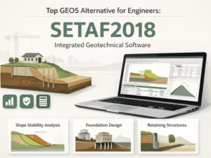
#1 SETAF2018 – Best for Field Data Collection & Automated Reporting
SETAF2018 focuses on the “Total Project Lifecycle” by ensuring that field data is not merely a collection of notes, but a structured dataset ready for production. Instead of a vague “validation,” the platform provides mathematical consistency checks and automated correlation analysis.
While traditional tools suffer from transcription “noise,” SETAF2018 ensures that data entered—such as SPT values or pressuremeter tests—is instantly cross-referenced with international standards (ASTM/ISO). This eliminates the “Administrative Gap” by transforming raw site data into a single source of truth that feeds directly into automated CAD drawings and authority-ready reports.
- Unique Selling Proposition (USP): It is the only platform strategically designed to bridge the gap between the drill rig and the final report, eliminating the traditional back-office lag.
- Key Features:
- Future-Ready Site Data Integration: While the current SETAF2018 ecosystem excels at processing idealized borehole data and in-situ test results (SPT, CPT, Pressuremeter) through its robust desktop interface, the upcoming SETAFMobile extension aims to bring this power directly to the field. This future integration will allow for offline-first data logging, enabling engineers to sync raw field observations directly with the analysis environment, further narrowing the gap between the drill rig and the design office.
- Multi-Standard Compliance & Lab Integration: SETAF2018 is engineered for global engineering practice, featuring full compliance with Eurocode 7. Its dedicated Laboratory Testing Module allows for precise soil characterization following ASTM standards, ensuring that raw lab data is processed through verified mathematical models rather than disconnected spreadsheets.
- White-Box Reporting: Unlike the “Black-Box” outputs of many high-end FEM tools, SETAF2018 provides total professional defensibility. It doesn’t just give a result; it generates reports that display every explicit mathematical step, variable substitution, and regulatory reference (e.g., Terzaghi or Meyerhof equations within Eurocode frameworks). This makes the approval process with municipalities and auditors significantly faster.
- Why it’s #1: Analysis is only as reliable as its input. SETAF ensures that the data fed into higher-tier engines is clean, standardized, and audit-ready.
#2 PLAXIS (Bentley) – Best for Complex FEM Analysis
PLAXIS remains the unparalleled benchmark for high-end geotechnical finite element software, particularly for Tier-1 infrastructure projects.
- Use Case: Ideal for high-stakes urban projects, subsea TBM tunnels, and seismic modeling where non-linear soil behavior is the primary driver.
- Highlight: It offers unmatched soil-structure interaction capabilities through advanced constitutive models like Hardening Soil.
#3 GeoStudio (Seequent) – Best for Groundwater & Slope Stability
For projects where the environment is as dynamic as the soil itself, GeoStudio provides a sophisticated multi-physics environment.
- Use Case: The standard for dams, levees, mining environmental assessments, and projects involving complex groundwater dynamics.
- Highlight: Features a robust integration of thermal analysis, air flow, and water movement within a single analytical suite.
#4 Rocscience (Settle3 / Slide3) – Best for Rapid Design Checks
Rocscience tools are engineered for the practicing engineer who needs high velocity without sacrificing reliability.
- Use Case: Optimized for quick 3D settlement predictions and identifying critical slip surfaces in slope stability assessments.
- Highlight: Known for its high speed of use and focused functionality, allowing for thousands of iterations in seconds via the Limit Equilibrium Method (LEM).
#5 Autodesk Civil 3D – Best for BIM Integration
Civil 3D acts as the connective tissue between geotechnical intelligence and the wider architectural and structural world.
- Use Case: Essential for visualizing subsurface data within a broader construction context, ensuring site grading and utility routing are based on accurate soil models.
- Highlight: Seamlessly integrates geotechnical data into the BIM workflow, making the engineer’s findings accessible to all project stakeholders.
Geotechnical Software Comparison: 2026 Buyer’s Matrix
To choose the right tool, you must distinguish between research-grade depth and industrial-speed production. The following matrix compares how these industry leaders perform across the core pillars of the 2026 geotechnical workflow:
| Software | Primary Focus | Best For | Modeling Efficiency | Reporting & Output |
| SETAF2018 | Production & CAD Automation | Standard Structures (90% of tasks), Shoring & Foundations | ⭐⭐⭐⭐⭐ (Auto-Macros & CAD Import) | Instant (White-Box / Full Math) |
| PLAXIS | Advanced FEM | Complex Infrastructure, Tunnels & Seismic Research | ⭐ (Manual Geometry / Node-based) | Manual (Table/Graph Summary) |
| GeoStudio | Multi-physics | Dams, Groundwater & Thermal Flow | ⭐⭐ (Modular setup) | Moderate (Modular Reports) |
| Settle3 | Settlement Analysis | Rapid Foundation Checks & Iterations | ⭐⭐⭐ (Template-based) | Moderate (Standard Tables) |
| Civil 3D | BIM Integration | Subsurface Visualization & Site Planning | ⭐⭐ (Office-Centric CAD) | Manual (Design Layers) |
Strategic Comparison Summary
- Workflow Structure: SETAF2018 utilizes a single integrated file approach, whereas tools like GEO5 or traditional suites often suffer from fragmented modules that require manual data re-syncing.
- Reporting Style: While most high-end software provides “Black-Box” summary tables , SETAF2018 focuses on White-Box reporting by displaying explicit mathematical steps and variable substitutions (e.g., Terzaghi equations).
- Drafting Output: SETAF2018 functions as a geotechnical CAD automation tool , generating professional project drawings and a detailed Bill of Quantities (BOQ) automatically. In contrast, PLAXIS and GeoStudio typically stop at the analysis result, requiring manual drafting in external software.
- Project Fit: Standard structures (shoring, retaining walls, standard foundations) represent 90% of daily engineering tasks. SETAF2018 is optimized for this high-velocity production , while PLAXIS and MIDAS are optimized for the complex 10% of projects requiring exhaustive numerical research.
Decision Guide: Selecting the Best Geotechnical Engineering Software for Your Firm
Choosing the right platform in 2026 is a strategic decision that balances computational depth with commercial efficiency. To optimize your firm’s return on investment (ROI), you must deploy the tool that aligns with your specific project lifecycle and production goals.
Use the following framework to determine which software deserves a permanent place in your technical stack:
- Choose SETAF2018 if:
- You want to eliminate “Modeling Friction”: While data is entered via interfaces in all software, SETAF2018 allows you to bypass the tedious manual drawing of geometries. By using automated parametric macros, you can generate complex shoring systems and foundation models in seconds—a process that requires manual line-by-line construction in FEA-centric tools like PLAXIS.
- You need to bridge the “Drafting Gap”: You are losing billable hours to manual CAD drafting. SETAF2018 automates the transition from analysis to deliverable by importing borehole and terrain data directly from AutoCAD and instantly exporting professional-grade, authority-ready project drawings (.dwg).
- Your workload consists of “Standard Structures”: For the 90% of daily projects (retaining walls, shoring, routine foundations), you need a production-speed tool that replaces manual calculation checks with a White-Box reporting system, displaying every explicit mathematical equation for rapid municipal approval.
- You aim for a “Zero-Transcription” Workflow: You want to minimize the risk of “noise” between the site and the office. SETAF2018 provides a structured environment where in-situ test results and laboratory data are standardized once and propagated throughout the entire design, ensuring your bill of quantities (BOQ) and reports are always in sync.
- Choose PLAXIS if:
- You are tackling the complex 10% of projects involving high-stakes non-linear soil behavior and complex structural loads, such as TBM tunnels or deep-sea infrastructure.
- Your project requires high-resolution Finite Element Method (FEM) analysis to resolve intricate soil-structure interactions where analytical benchmarks are insufficient.
- Choose GeoStudio if:
- Environmental factors and multi-physics integration are critical, such as analyzing groundwater flow, thermal changes, or air flow in dams and levees.
- You require a specialized focus on slope stability combined with complex hydraulic conditions.
- Choose Rocscience (Settle3 / Slide3) if:
- You need high-velocity analytical design checks for 3D settlement or rapid slope stability iterations using the Limit Equilibrium Method (LEM).
By strategically selecting SETAF2018 for your mainstream production and reserving specialized tools like PLAXIS for research-grade complexity, you can maximize workflow velocity without compromising on scientific rigor.
FAQ: Geotechnical Software 2026 (SEO Optimized)
Navigating the transition to digital workflows often raises technical and strategic questions. These FAQs address the core concerns of engineering firms looking to modernize their technical stack in 2026.
Q: What is the best geotechnical design software for beginners?
A: For engineers transitioning away from manual methods, the priority should be an intuitive interface that balances academic rigor with ease of use. Tools like SETAF2018 for reporting and GEO5 for design are widely regarded as the most accessible entry points due to their application-oriented logic. These platforms reduce the steep learning curve associated with traditional finite element modeling by focusing on standard engineering tasks like foundations and shoring. By providing immediate feedback and automated outputs, they allow beginners to focus on developing engineering judgment rather than debugging complex meshes.
Q: Can I integrate field data with PLAXIS or Civil 3D?
In a modern engineering workflow, the most efficient strategy is to use SETAF2018 as your primary production and design environment before moving to advanced FEM tools. For complex projects requiring high-end finite element analysis, you can complete your entire preliminary and structural design—including shoring, foundations, and slope stability—within SETAF2018. This allows you to leverage its automated CAD imports and rapid parametric modeling to finalize your design logic.
Once the design is established, you can then use specialized engines like PLAXIS for final verification of non-linear soil behavior or Civil 3D for broader BIM visualization. While these platforms currently function as independent stages of the workflow, using SETAF2018 as your initial “design hub” ensures that your core engineering deliverables are ready for production, while reserving heavy numerical tools for the final, research-grade validation of the most complex project elements. This tiered approach maximizes both production speed and scientific rigor.
Q: Is gINT still the industry standard?
While gINT was once the ubiquitous legacy giant for borehole logging, the industry in 2026 has largely migrated toward cloud-native and production-focused solutions. Most firms are now adopting platforms like SETAF2018 or OpenGround due to the sunsetting support of legacy software and the need for offline-first mobile capabilities. Modern alternatives offer superior integration with CAD and 3D modeling environments, which gINT lacks. The shift is driven by the demand for “White-Box” transparency and the ability to generate automated, authority-ready reports directly from field data.
Q: How does geotechnical software improve ROI?
Adopting production-oriented geotechnical software directly improves a firm’s bottom line by eliminating the heavy administrative burden of manual drafting and repetitive modeling. In traditional workflows (and even in high-end FEA tools like PLAXIS), creating shoring or foundation geometries is a manual, line-by-line process.
SETAF2018 transforms this by using automated parametric macros, allowing engineers to generate complex site models and structural geometries instantly. By automating the transition from initial design to finished CAD drawings (.dwg) and calculation reports, firms can cut production time by up to 70%. Instead of spending billable hours on manual CAD drafting or debugging manual geometry entries, senior engineers can focus on high-level optimization and consulting. Furthermore, the ability to generate a precise Bill of Quantities (BOQ) directly from the model ensures accurate cost estimation, significantly reducing the financial risk of budget overruns during construction.